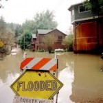
Flood Survey – Elevation Certificate
If you want to get a flood survey or need an elevation certificate for your home location to determine if you are located in a flood hazard zone, please call Alexander City Land Surveying at (256) 392-8208 or send us an e-mail with your name, address and phone number to [email protected].
“…this [elevation survey & certificate] helped [our client] a lot – quote went down from $2,599 to only $460.” – Staci, State Farm Insurance
Flood Survey – Elevation Determination using FEMA Flood Maps
Recently many counties in the state completed the updating of the FEMA Flood Insurance Rate Maps (FIRMs) for determining flood hazard zones for a specific area. Tallapoosa County, Elmore county, and Coosa County are included in this list. Flood maps show the areas of potential flooding based on the 1-percent chance storm event.
The 1-percent chance storm has been known as the 100 year flood and is also officially called the Special Flood Hazard Area (SFHA). When you rain amounting to the 1-percent storm the water will come to a certain elevation near your home. This is called the Base Flood Elevation (BFE). For those homeowners with a mortgage, buying a flood insurance policy is required if you are located in a community that participates in the National Flood Insurance Program. Most of the communities within Tallapoosa, Coosa, and Elmore Counties are participating communities. The federal government insures the landowners and regulates this as well. Local insurance companies only act as application submitters.
A flood insurance policy is very advisable even if you’re not required to have it BUT you are located near a stream or lake. You should have a flood survey done and seek the advice of your land surveyor and insurance agent. Realize that the 1-percent chance storm has a 1 percent chance of being MET OR EXCEEDED in ANY year. Over the span of a 30-year mortgage you have a 26% chance of having a flood that exceeds the BFE, thereby putting you at risk of flooding. Flood insurance premiums are normally less the higher above the BFE that your finished floor is situated. So, if you are three feet above the BFE your rates should be lower than if you were below the BFE.
A minimal policy could well be worth the peace of mind it brings. All homeowners insurance policies have an exclusion for flood damage. Since FEMA covers this they have no reason to do so. You should also know that even if you’re above the flood elevation and far away from a stream or lake, many ditches have caused damage to homes during a flash flood event. Again, your homeowners policy is useless in this case but a flood policy would cover this damage. A flood survey, which produces an elevation certificate, is done in order for you to be able to apply for a flood policy, thus it will give you an idea the flood hazard at your location.
Purchasing flood insurance is mandatory…..if the loan is federally insured or the lender is regulated by the federal government
Flood Survey: FEMA needs an Elevation Certificate to Determine the Premium
 As stated above, the mortgage company will probably ask you to purchase flood insurance for their protection. You should know too that the lender may also require flood insurance even if it the surveyor determines you don’t need it. While this is not normal, it is their choice. But, the rates should be low in this case.
Now that you know a little about the subject, how does the flood situation affect you? If you are shown to be in or near a flood hazard zone, you need to act. The following situations are possible:
1. Your home and lot are not shown in a flood hazard zone at all on the current flood maps. This is great. In this case you don’t have to purchase flood insurance. But, if there is ANY risk you might want to consider it. An evaluation of your risk is quick and easy.
2.Your lot, or a portion of your lot, is shown in a flood hazard zone on the flood maps. This requires you to purchase flood insurance. Your situation may now be:
a.Your lot is “in” the flood hazard zone but the lowest adjacent grade (LAG) around your house is above the base flood elevation (BFE). It is possible, in this situation, to remove the requirement for flood insurance. The process to do this is called a Letter of Map Amendment (LOMA). Talk to your land surveyor about this process.
b.Your lowest adjacent grade (LAG) is below the BFE but the finished floor elevation (FFE) is above the base flood level. You need flood insurance. Get a flood survey and an Elevation Certificate so that FEMA can determine your flood insurance premium.
c.Your lowest finished floor elevation (FFE) is below the base flood elevation. This is similar to 2.b. above but your flood risk is higher. Again, get a flood survey completed.
If you’re in any of the situations under number 2, the first step is to get a a flood survey and an elevation certificate. The land surveyor will measure the elevation of the finished floor of your home, the lowest adjacent grade to your home, and determine the base flood elevation. After this the surveyor will produce an Elevation Certificate so you can either complete the LOMA process or get a quote on flood insurance.
For more specific information about the National Flood Insurance Program, see the web at floodsmart.gov. To review FEMA’s Flood Maps in your area, go to FEMA Map Service Center.
